.png)
Topographic Survey
Oldham
Looking for a topographic survey Oldham? Our professional land surveys capture vital site information, helping architects, engineers, and developers make informed decisions.
Our topographical surveyors in Oldham give our clients clear, accurate details of land, boundaries and site features for planning, design and construction.
Using modern survey equipment and digital modelling, we help local architects, engineers and developers understand levels, structures and access before work begins.

Topographical Surveyors In Oldham
Topographical surveyors in Oldham carry out detailed surveys to record the shape, levels and features of a site.
Our topographical surveys involve measuring land contours, boundaries, buildings, trees, roads, drainage points and other key details. We then use this information to create accurate plans or digital drawings.
These surveys help our clients understand the site clearly before planning, design or construction work begins, reducing risks and supporting better decisions from the start of each project.
Oldham Topographic Survey Services
Oldham topographic survey services help clients understand a site before planning, design, or construction begins. We measure land levels, boundaries, buildings, access points, trees, drainage and other key features. Our team uses this information to produce clear, accurate drawings that support architects, engineers, developers and property owners with safer, better-informed project decisions.
Topographical Surveys
Our topographical surveys in Oldham give clients a clear view of land levels, boundaries, features and site conditions. We record details such as buildings, roads, trees, drainage and access points, then produce accurate drawings for planning, design and construction. This helps projects move forward with greater confidence and fewer unknown issues.
Measured Building Surveys
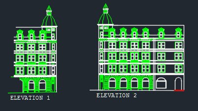
With measured building surveys in Oldham, we record the layout, structure and key details of existing buildings. This can include floor plans, elevations, sections and roof plans. The information supports design, renovation, planning and property work, giving architects, developers and owners accurate drawings to base their next steps on.
3d Laser Scanning Surveys
Using 3d laser scanning surveys, we capture detailed site and building data quickly and accurately. This method records millions of points to create a clear digital picture of a space. It is useful for complex sites, older buildings, design work and projects where precise measurements are needed before decisions are made.
3D Laser Scanning Surveys Oldham
Site And Structural Monitoring
For site and structural monitoring in Oldham, we track movement, settlement and changes in buildings, land or structures over time. Regular checks help identify possible issues early and support safer project management. This service is often used during construction, nearby development, excavation or works where existing structures need careful protection.
Site and Structural Monitoring Oldham
UAV Drone Surveying
Through UAV drone surveying, we collect useful site data from above, including images, measurements and land details. Drones are ideal for large, hard-to-reach or busy sites, helping reduce time on site while improving safety. The results support mapping, inspections, progress checks and planning for many project types.
Site Engineering Services
As part of our site engineering services, we support construction projects with accurate setting out, levels, control points and site checks. This helps contractors build in the right place, to the right measurements and with fewer errors. Our work supports smoother progress from early preparation through to completion.
Oldham Drone Surveyor
Drone surveyor checks site levels, boundaries, access, structures, roof areas, land features and possible hazards from above. Before each survey, we assess the site, confirm the required data, plan safe flight paths and check weather conditions.
Our surveyors in Oldham then capture clear aerial images and measurements, helping clients understand the site quickly and plan work with greater accuracy.
Geodetic Or Plane Surveys Oldham
Geodetic or plane surveys in Oldham are widely used to measure land, but they work in different ways. Plane surveys treat the earth as a flat surface, so they are best used to assess much smaller sites where the earth’s curve does not affect results.
Geodetic surveys allow for the earth’s shape and are used across larger areas. We choose the right method based on site size, accuracy needs and project aims. This helps our clients receive clear, reliable survey information.
Oldham Topographic Survey Near Me
When searching for topographic surveys in Oldham, you’ll always need to look for a service that gives clear, accurate site information before any of the work begins.
We provide detailed surveys that record land levels, boundaries, buildings, trees, drainage, access points and other important features. This helps architects, engineers, developers, contractors and property owners understand the site properly.
Our surveyors use modern equipment to collect reliable data, which is then turned into clear plans or digital drawings. These surveys can support planning applications, design work, construction, extensions and land development.
By choosing our local topographic survey service in Oldham, clients receive practical information that helps reduce mistakes, manage risks and keep projects moving in the right direction.
If you require a topographic survey in Oldham and the surrounding areas contact our specialist today. Call 01253 766 135.