2D and 3D Laser Scanning Surveys
Blackpool, Lancashire
If you are looking for 2D and 3D laser scanning surveys in Blackpool, Lancashire and the surrounding area, contact our expert today.
As technology advances, so do the services in the fields of architecture and surveying. Thanks to cutting-edge innovation in laser technology and advanced accuracy in ranging, we can now capture complex geometric details or inaccessible surfaces with rapid efficiency.
3D laser scanning is also referred to as Light Detection and Ranging. It projects laser lines that don't reflect over targeted surfaces, and the camera sensor captures all the data relevant to the surface. It is powered by a camera sensor meant to record all the surveyed points by the laser scanner.
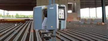
One very efficient, reliable and highly accurate 3-dimensional scanner is the Trimble TX5 high-speed scanner. Its scanning range spans up to a versatile 120 metres, and it can collect reliably accurate data in no time.
The Trimble TX5 high-speed scanner saves money by eliminating the need for potential revisits. It also eliminates measurement errors that may warrant reworks and fitment repeats.
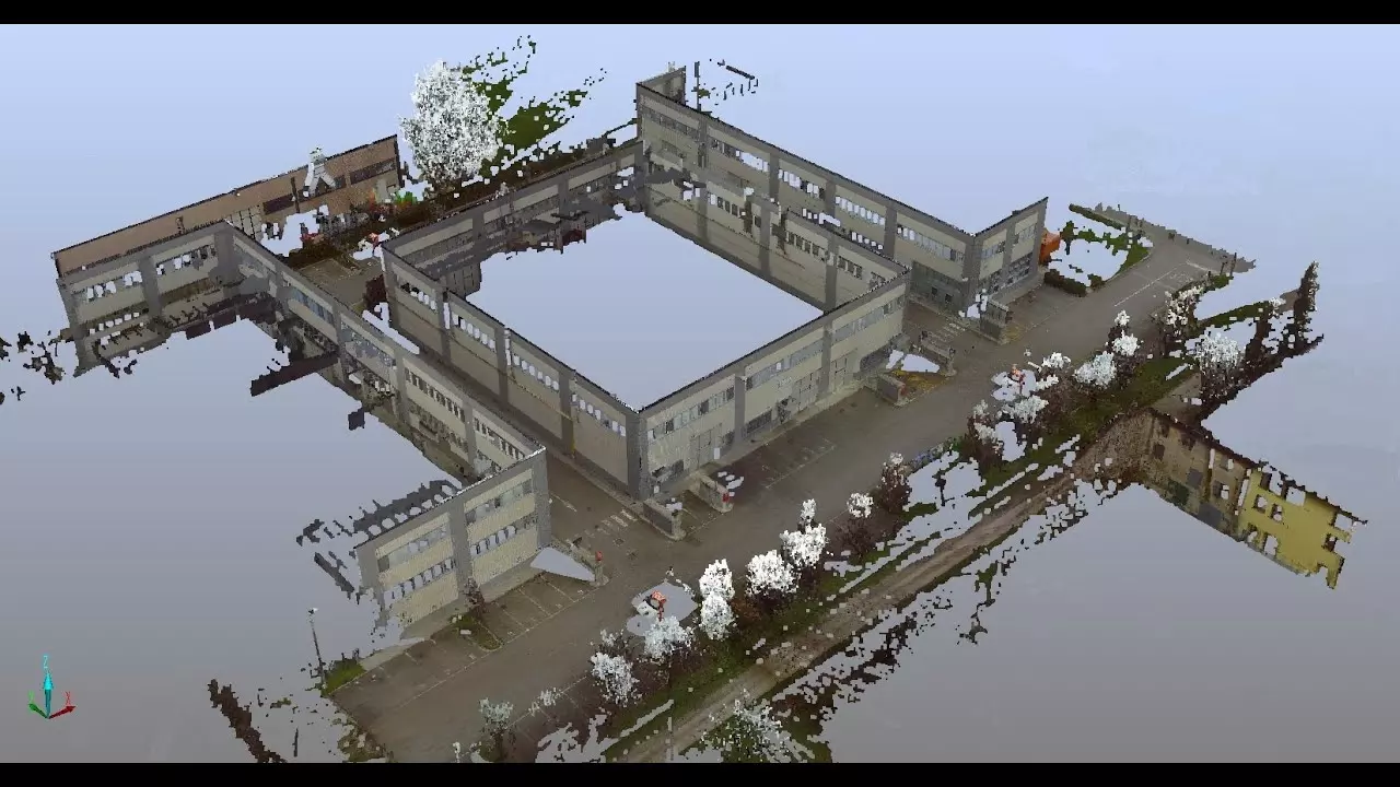
The data processed by the Trimble Realworks is able to produce a 3D point cloud. Using the point cloud, we can offer a number of export options such as:
- Produce 3D model
- Produce 2D plans and elevations
- Export cloud to CAD package
- Fly through movie
- Volume and surface calculations
What are the benefits of 3D scanning?
The 3D scanner provides impeccable precision for the millions of points its collects and appreciates the colour contrasts within targeted surfaces. That's why it is ideal to making architectural documentation for contrast, record, refurbishment and industrial purposes.
Unlike contact surveying, Light Detection and Ranging comes in handy for measuring and representing surfaces that are difficult to access, not to mention the speed at which it carries our the process. 3D scanning also provides a more accurate way of surveying; it eliminates the need for making assumptions on details that may seem minor or insignificant. It minimises generalisations and eases data analysis through automation. It provides accurate data sets to which users can infer later when making structural decisions and reports.
Extracted Deliverables:
2D
- Linework extracted as to a standard CAD, DXF or DWG file
- Roof plans
- Topographical plans
- Cross and long sections
- Clearoute sections
- Building and structure elevations
3D
- 3D wireframe line models (DXF / DWG)
- BIM in Revit or IFC for import into other BIM systems
- Animated visualisations (AVI or MP4)
- Rendered 3D models (AutoCAD, 3DStudio or Sketchup models)
- IMP, PTX, PTS, POD files (Pointools)
If you require 2D and 3D laser scanning surveys in Blackpool, Lancashire and the surrounding areas contact our specialist today. Call 01253 766 135.