Blackpool, Lancashire
Topographical Surveyor Services
If you are looking for an experienced topographical surveyor for land surveys throughout the North West, look no further than G J Brookes Ltd. We are your first choice for Topographical Surveyor Services in Blackpool, Lancashire and the surrounding areas.
Founded in 2002, we offer over 20 years of experience in the construction and surveying industry. From our base in Blackpool, our work takes us all over the North West and beyond. To better serve our clients, we use Leica survey equipment, along with an LSS 3-D modelling software program to produce the best quality services that we can.
G J Brookes Ltd
Call today 01253 766 135.
What is a drone Topographic Survey?
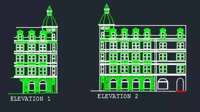
A Topographical Survey is a highly detailed and scaled depiction of land, property or a defined area boundary.
Relating to a site, whether natural or artificial man-made, a topographical survey can provide and gather spatial information. It tells a planner, engineer or architect all about the terrain and any of its elevations.
Surveys such as this can help architects and design teams spot any surrounding land's height and manmade features such as trees, hills, buildings, fences, rivers or streams.
These gradient transects also allow us to determine the abundance of species on-site, any neighbouring properties to be aware of, as well as information on underground utilities.
From the topographical survey details, we can then produce our 3D visualisations and begin ground modelling. They are critical for those planning any construction work, especially any extensive construction work.
A reliable and credible surveying company will save any planner, architect or builder a lot on expenses. Drones have been lucky and effective when it comes to the job of topographical surveys.
The drones' data connects to the ground system controls, speeding up the process and carrying out any necessary assessment before construction work.
Why use a drone survey? See below the main reasons for using our services:
Cost-effective
Time-effective
Improved health and safety
Minimal disruption to property
Surveying inaccessible locations
Improved data acquisition
There are several varieties of topographical survey methods that teams can use. Both modern technology and traditional methods can be incorporated when taking these topographic surveys.
There are boundary surveys, general land surveys and surveys that deal exclusively with construction projects in detail. Mapping is also a big part of topographical surveys or any survey under the guise of construction.
Their level of accuracy often determines the method used alongside the scale of the boundary or land location.
The different types of strategies can classify varieties of information about the area of the land itself. A key piece of equipment used in topographical survey methods is robotic total stations instruments.
This device measures and details all aspect points, and the surveyor strings these points together to create an outline with a code for the building.
The duration of time these methods takes can vary, and it all depends on the scale of the site and the desired scale of the construction that the employer wishes to begin.
Topographical Survey Methods

Do you require a land survey?
Land surveys are more frequently used to detect the distances and particular angular points on a site or land.
If you require a land survey, you may want to establish land boundaries for ownership, which is why we can use them. Land surveys allow us to determine the placement of any buildings or roads.
Commonly they are called Geodetic or Plane surveys. Geodetic considers larger pieces of land and aim to achieve much precision. Plane surveys, however, deal with smaller areas; thus, do not consider any bumps and curves in the surface.
If you are unsure as to what kind of survey you may require, contact G J Brookes Ltd, and we may offer advice.

There are different areas of which Land surveys can divide up. The main categories include;
Engineering surveys, where the survey detects the place of the building's construction and if it is in the correct position and location.
Standard land surveys accurately describe the site lines and closely calculate the surrounding land areas. Informational surveys can use maps, sketches or drawings and charts.
Types of Land Surveys

Topographical Surveys

Measured Building Surveys

3D Scanning

Site Engineering

Structural Monitoring

UAV Drone Surveys
G J Brookes Ltd produces topographical (land) surveys for our clients. Our services include drawing highly precise plans that identify natural and unnatural topographical features in a predetermined area.
This plan also shows unnatural features such as service covers, site levels, boundaries, and buildings. They are usually dispatched as CAD files or as scaled-down plans on paper.

What are Topographical Surveys?
Topographical surveys are requested for a number of reasons, usually by engineers, planners, and architects to help with the planning and design of their specific project.
No matter what project you are considering, ensure that you employ a trustworthy surveying company.
A reputable surveying company will save you money in the long run, as they will be able to inform you of potential issues beforehand. G J Brookes Ltd is dedicated to providing the highest standard of service for our clients.
Topographical Surveys Near Me
With the help of our topographical surveys clients can get clear, accurate site information from a local survey team. We record land levels, boundaries, buildings, trees, drainage, access points and other key features. Our surveys support planning, design and construction by giving clients reliable drawings that help reduce risk, avoid delays and make better project decisions.
Please Note: If your location isn't specified here, please feel free to get in contact with us as we may be able to cover your local area.

Topographical surveys are used by architects, government agencies, engineers and builders for many different important reasons. For example, these surveys are important to an architect if they are designing a 3D version of their plan, as the surface elevation of the specific piece of land needs to be measured.
If the land is being built on or is being sold to another owner, then a topographical survey must be completed. Topographical surveys are also needed to find out the specifications of the piece of land, including the shape, the position of the land (geographically), the level of the land and the form if the land. They can also find out the features of the land that could affect its uses.
Why are Topographical Surveys Needed?
How is a Topographical Survey Carried Out?
A topographical survey is carried out using GPS, EDM and other surveying equipment. The survey itself is carried out in a range of steps to ensure everything is covered, and the process is done precisely and correctly. The time it takes to complete the topographical survey will depend on the amount of land there is. Here are the steps to completing the survey:
STEP 1
Firstly you need to find out all the specifications of the land, including the size, level, form, and geographical area
STEP 2
Next, a free quote is decided, with no obligations, and an estimated time frame is given to the customer
STEP 3
Then all the data about the land needs to be gathered to prepare everything for the final result
Request Your Free Quote
For your free, no-obligation quote, please contact us with detailed information of the site. Generally, we'd require the site's address or postcode, along with a brief description; but any information would be convenient for us.
After receiving this information, one of our chief surveyors will be in touch to discuss your project in more detail, with a proposal that details our fee, the timescales, the survey scope, and deliverables.
Heritage Recording
Our services also provide a lucrative solution to the many recording issues with heritage buildings. This would include photographic records of sites, artworks, structures, and objects.
We are experienced in providing photographic archives in a digital format in high and normal (dynamic) range formats for either conservation management or scholarly research.
Take the stress out of planning- count on G J Brookes Ltd for your surveying needs.
If you require Topographical Surveyor Services in Blackpool, Lancashire and the surrounding areas contact us today. Call 01253 766 135 today to discuss your requirements.
Get In Touch
G J Brookes Ltd
14 Joyce Avenue
Blackpool
Lancashire
FY4 4HL